
Uttarakhand: Gaumukh Tapovan
- v e
- Oct 5
- 7 min read

Date: 23rd to 29th Sept, 2025
After completing the Deoreotal Chandrashila hike, I decided to take on more challenging hikes, so I switched to Gaumukh Tapovan. Although this is not a difficult hike, I would classify it as moderate, as most of the sections have little or gradual elevation gain. The hike spans about 22 kilometers one way, with an elevation gain from 10,000 ft to 14,200 ft. If it were up to me, I would have gone solo to Gomukh Tapovan in 2 days and stayed at Tapovan in an ashram for 3 days to enjoy the beauty and tranquility of the mountains. I highly recommend everyone consider this as a solo hike, as there are ashrams at various camp sites.
After completing the Phulara Ridge hike, I received messages about a cloudburst in Dehradun and several roadblocks due to rock erosion however, I'm relieved that the hike wasn't rescheduled. I stayed at Kamal Kunj Homestay, where I cooked some delicious meals. It was the best homestay I've experienced in India, with an amazing host, great place with all the amenities and peaceful surroundings. The next day, I moved to Live Free Hostel, which is also nice, as my pickup spot was early in the morning.
Day 1: As usual, the first day is the toughest part of the hike as it involves traveling from Dehradun to Gangotri. We were picked up around 6:30 AM and arrived in Gangotri by 4:30 PM. Sitting in the Bolero was stressful, and since I suffer from inconsistent sciatic nerve pain and hemorrhoids, I was anxious that the sitting position might cause these complications which is not the case.

Due to cloudbursts and road conditions, more than half the team withdrew, leaving us with only 5 hikers, 3 guides, and 1 porter.On the way to Gangotri had to stop at Harshil as this is where massive landslides happened, also famous for selling fresh apples from the garden.
We visited the Gangotri temple at night to explore the area and walked through the main street to check out the shops.Gangotri is located at an elevation of approximately 10,000 feet, with the River Ganga flowing beside the temple.


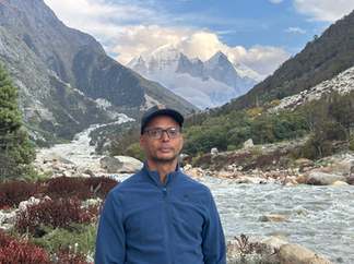
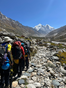
Day 2: On each day of every hike, IndiaHikes generally follows a schedule of waking up at 6 AM, having breakfast at 7 AM, and starting the hike at 8 AM. Since I don't eat breakfast, I packed it to have at lunchtime. Within ten minutes of leaving the base camp, we pass by the Gangotri temple and then proceed along the river, with views of various mountains. Unlike other regions of Uttarakhand, the mountains here are taller and drier, making the snow-capped peaks particularly memorable, as you will see further down the page.
View of the Gangotri check post from a distance.
As you approach the base camp you will start noticing Nandan peaks, Bhagheerathi peaks, glimpse of Mt Meru.


Group photo with the boys

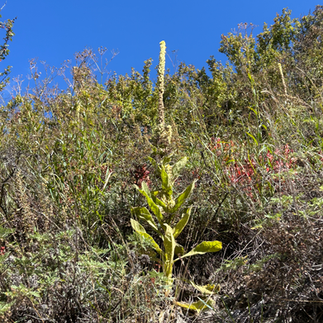
While on the trail, you'll observe numerous pine trees and small shrubs bearing berries. It seems that many bears inhabit this area and consume these berries. I noticed several piles of bear droppings along the trail, which adds a bit of a thrill to the nighttime tales. :)


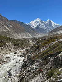
We arrive at Chirbasa, located at 11,600 feet and approximately 10 kilometers from Gangotri. The campsite is stunning, surrounded by trees and rocks. A great feature is that you can relax on the ground in the shade instead of inside the tent when it's sunny. Many of the trees in this national forest have been planted by people to create a reserve, which is highly valued. One can also enjoy a fantastic view of the Bhagheerath peaks near the tent, with the river flowing through.
Group photo at the camp:


Day 3: This is a shorter hike, covering approximately 5 kilometers, reaching an elevation of 12,415 ft at a place called Bhojbasa. At this stage, we noticed that one of the hikers was a bit slower due to the sun affecting him and having eaten bad food on the first day at a local restaurant. Fortunately, we managed to complete the hike, and the smart decision he made was to offload some of his belongings to the porter the next day, which improved his pace.


There are couple of places where there are loose rocks, so we had to wear a helmet for our safety

Again the views are spectacular and continue to improve. We will have an unobstructed, clear view of the Bhagheerath mountains. The campsite is located on open ground, with the sun shining directly on us as we arrived around 2 PM, and it was hot inside the tent.


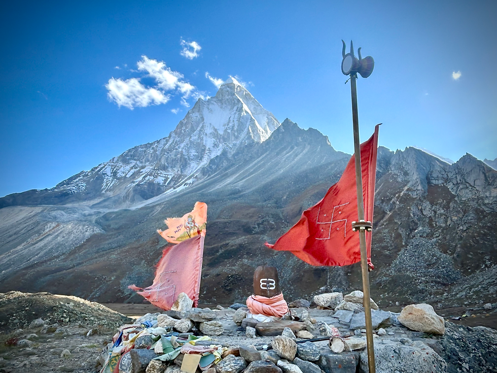
We encountered some fellow hikers, locals, and a swami. People engaged in meaningful conversations, enriched by the swami's life story. There are a couple of ashrams where solo hikers can stay, which I plan to do next time. Additionally, there is a small Shiva temple for those who are religiously inclined.

This young man, a 17-year-old high school graduate from Nepal, served as our porter. Despite having minimal winter gear, on his slippers, carried 30 kg of items on his back. His speed was unmatched; our downhill pace was equivalent to his uphill speed with the load. An incredible individual with a spirited attitude.
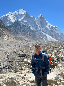
Day 4: This is the challenging segment of the entire hike to reach Tapovan, which is about 6 km away. Tapovan is at an altitude of 14,203 ft, meaning there's a 600m ascent over 4 km. Early in the morning, we had to use a trolley to cross over, and it was enjoyable to pull fellow hikers across with this pulley :). For over a kilometer, the trail is straightforward with minimal elevation gain, but it becomes harder as it passes through a boulder section with significant elevation increase. Additionally, the sun starts to heat up as you ascend. Unfortunately, there is only one stream with drinkable water, so ensure you carry 2 liters of water for this stretch.
This time, a different hiker began to slow down and feel tired because his backpack was dragging him back, and the weight was pressing on his shoulders. I chose to assist him by swapping my backpack with his, as mine was lighter and better suited for hiking. It seemed to help him a lot on the trek. As we ascent we start getting closer to the Mt Bagheerath peaks and Mt Shiv Ling starts opening up. Since the ascent is rocky we didnt have lot of shade to hide from the sunny so folks had lunch under the Sun. We also spotted some mountain goats on the way to the camp.


Despite the intense heat, a stressful day, and limited water, the experience is entirely worthwhile as it reveals a breathtaking views of the Bhageerathi and Shiv Ling Mountains, with glimpses of Mount Meru peeking from behind Shiv Ling Mountain. There's also another ashram here where yogis practice, and visitors can stay as well. The leisurely hiker is delighted to encounter some yogis and receive life advice from them. :)


View of the Mt Bhagheerathi peaks from the camp site:


I always try to chat with the kitchen folks as i love cooking and had some pleasant conversation in the evening.
Day 5: I rose early morning to take some photos of the mountains one las time.
View of the Mt Shiv Ling from the camp:


Some group photo with the entire crew:

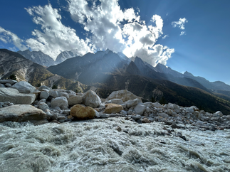
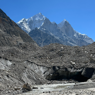
Today, we return to Bhojbasa, passing through the Gomukh area, where you can see the glacier up close and witness the origin of the Bhagirathi River, part of Ganga river. All hikers collect the holy water, take some time to rest, and then proceed to the base camp. I find this part of the hike quite enjoyable as you can run down the sliding sections of the downhill. It reminded me of the Mt. Rinjani hike, where we ran down the hill. However, caution is necessary, especially with larger boulders that can wobble and twist your ankle or knee.


At the campsite, I encountered three climbers getting ready to hike to the summit of Mount Shiv Ling: a German, an American, and an Indian. It seems it takes a month to reach the peak due to the time spent acclimatizing, transferring supplies, and setting up ropes. Meanwhile, here I am thinking I could do it in just a few days - rookie mistake, silly me ;).


Day 6: The final day to reach Gangotri, covering over 15 km. On this day, hikers guide themselves, deciding where to stop, eat, etc. The slowest member, whose backpack is heavy, was chosen as the leader for our hike. Once again, I decided to assist him by carrying his bag and both of our lunch boxes. We set a goal to maintain a gap of no more than 5 minutes between the leader and the sweeper, as I appointed myself as the sweeper. The new leader did an outstanding job by setting a great pace. I believe he was motivated and tried to push himself. I encouraged him further by suggesting we skip lunch and eat only upon reaching Gangotri. However, about 2 km before the base camp, he had to listen to the other hikers as they were quite exhausted. It was truly a great display of spirit by him and the entire team.

In the evening, we returned to the Gangotri temple, captured some photos, and enjoyed our dinner. The following day, we traveled to Dehradun. Overall, I would describe it as one of the most remarkable hikes, offering stunning views of the Himalayas and serving as a spiritual destination for people worldwide.


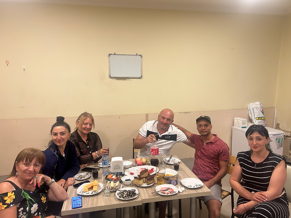
Interestingly this is the first hike lead by our IndiaHikes Trek leader so he had us to cut the cake, I hope we remain his best group of hikers ever, well atleast for this route :).

Day 7: we headed back to Dehradun, we all purchased few kgs of apples as they were fresh. I could easily count around 300 apples on one tree :).


BTW thanks everyone for contributing the photos and experience :).
At night, I stayed in Haridwar, which turned out to be a poor choice because the area is dirty, overcrowded, and expensive. However, the next day, I stayed at a lovely place in Rishikesh.


I returned home on Oct 2nd, at 1AM the day of Dasara and had amazing food with lots of custard apples :).


Comments